
Our Client

U.S. Army Corps of Engineers (USACE) Cold Regions Research and Engineering Laboratory (CRREL)
CRREL works to solve interdisciplinary, strategically important problems impacting warfighters and the nation by developing and delivering transformative technical solutions that meet operational challenges in cold and complex environments. The lab provides mission-essential geospatial support to all components of USACE, the U.S. Army, and the U.S. Department of Defense (DoD).
After more than a decade providing testing and evaluation of elevation data and software for geospatial activities across the DoD and U.S. Intelligence Community, GCS Geospatial was tapped to extend this expertise to the U.S. Army Corps of Engineers CRREL as a subcontractor through the Defense Technical Information Center’s (DTIC) Information Analysis Center multiple award contract (IAC-MAC).
The Challenge
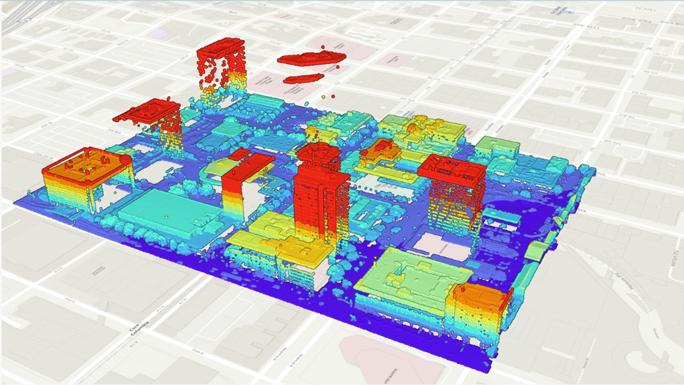
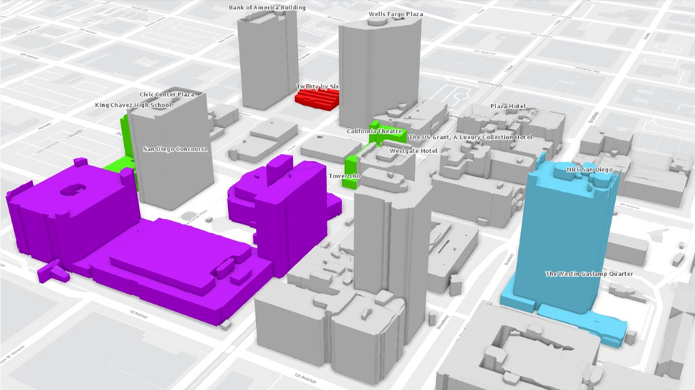
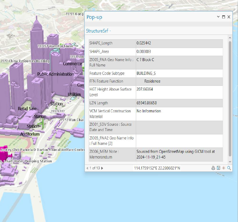
Beginning in 2024, GCS experts have provided testing and evaluation services for a CRREL project that automates the process of populating 3D geospatial features — such as attributes of buildings and other structures—from readily available geographic data sources. By comparing automated data acquisition products against ground truth datasets and testing them for accuracy, completeness, and speed, GCS is able to evaluate them alongside existing manual data acquisition methods of populating geospatial features of interest for mission applications.
Our Impact
Testing and evaluation provided by GCS experts aims to help CRREL improve upon time-consuming, manual methods of 3D geospatial data acquisition. If automated data acquisition tools prove successful, they would enable more rapid, accurate geospatial data for 3D features in any area of interest—a process that currently can take analysts hours of manual searching to complete. By saving time on data acquisition, analysts will free up significant time and resources to analyze and utilize data for map products to aid situational awareness and other mission objectives.
Conclusion
This effort will empower analysts to automate 3D data acquisition in complex environments, accelerating the delivery of actionable intelligence in support of warfighter operations. By minimizing the time spent on data discovery, analysts can devote more effort to mission-critical analysis. GCS Geospatial’s proven expertise in testing and evaluation ensures that mission data is accurate, reliable, and fit for purpose. We remain committed to supporting the geospatial intelligence community and its diverse mission sets. To learn more about partnering with GCS Geospatial, contact us today.
Images courtesy of GeoAcuity